this post was submitted on 08 Jul 2023
12 points (100.0% liked)

OpenStreetMap community

3561 readers
33 users here now

Everything #OpenStreetMap related is welcome: software releases, showing of your work, questions about how to tag something, as long as it has to do with OpenStreetMap or OpenStreetMap-related software.

OpenStreetMap is a map of the world, created by people like you and free to use under an open license.

Join OpenStreetMap and start mapping: https://www.openstreetmap.org.

There are many communication channels about OSM, many organized around a certain country or region. Discover them on https://openstreetmap.community

https://mapcomplete.osm.be is an easy-to-use website to view, edit and add points (such as shops, restaurants and others)

https://learnosm.org/en/ has a lot of information for beginners too.

founded 4 years ago
MODERATORS
 

Did you recently (or not recently) map a cool area that you want to show? Something you are proud of? Post it here! A little explanation of why it is cool might help as well.

top 5 comments
sorted by: hot top controversial new old
[โ€“] pietervdvn@lemmy.ml 7 points 1 year ago (1 children)

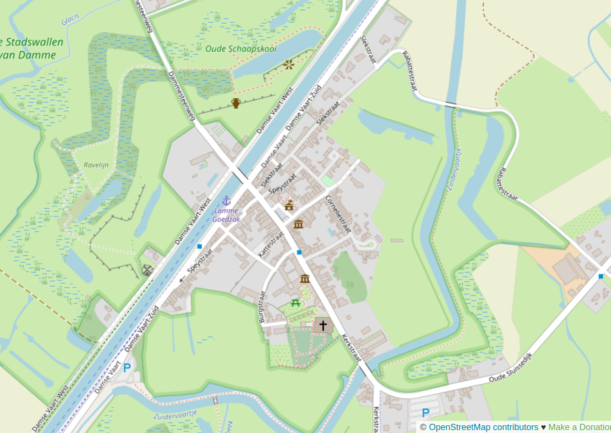
This is a small city in Belgium. The fortifications are a Vauban Fortress; but most parts of those medieval fortifications are now nature reserve (and protected as heritage). Some parts are open water, others are swamps.

However, most of the north-eastern side of the fortress was mapped as "forest" or something generic. After visiting it, I started micromapping this bit by bit. Upon saving and refreshing, the underlying structure of the fortress was suddenly visible, which was a nice surprise!

[โ€“] marco@fedi.vdheide.net 1 points 1 year ago (1 children)

@pietervdvn

Hi Pieter, do you have a screenshot of this?
Or a pointer into OSM?

I only see the text, no image ๐Ÿ˜ž

[โ€“] pietervdvn@en.osm.town 2 points 1 year ago

@marco @pietervdvn@lemmy.ml Hi Marco,

That is because you are looking to a lemmy post from Mastodon. Seems like the images don't come through properly. Visit https://lemmy.ml/post/1852015 and you'll see the picture.

[โ€“] nnachtigal@discuss.tchncs.de 4 points 11 months ago (1 children)

This is what I am proud of. I didn't map the original outline of the building, but I did the different building parts including heights for 3D view, entrances, the tunnel through the building and the courtyard.

[โ€“] nnachtigal@discuss.tchncs.de 3 points 11 months ago

Might need fixing though. In 3D view there are 2 buildings on top of each other. The stuff that I did, and then the basic structure. So I guess the other thing would need to be deleted?